Miscellaneous Pictures.

Demolition of livestock pens, Bargate, 1974.

Bottle from the Eagle Brewery, Boston.

The Bath Gardens and old General Hospital.

Potato weigher, made in Boston.

T.V. detector in Tower Street.

Strait Bargate, 1964.

Building the Starlight Rooms, 1960's.

Boston Station, 1962.

32, Market Place, near where the Waterfront pub is now.

Advert for Wright's garage, Wide Bargate.

The Ferry from Skirbeck Road to Edwin Street, off High Street.

The livestock pens and bull ring in Wide Bargate, the Red Cow pub is in the distance.

The Merseybeats 'down the dance' in the 1960's.

Middlecott Almshouses, demolished in 1966. Middlecott Close was built on the site.
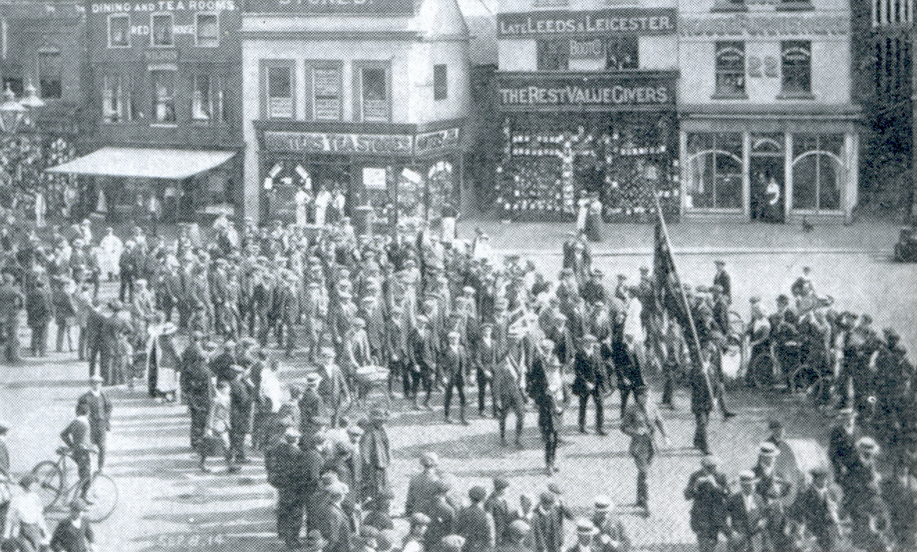
The Market Place,1914. Recruiting for World War One.

Boston & District Ploughing Society celebrations, unknown date.

The Corn Exchange.

The corner of Stanbow Lane and Pinfold Lane in 1964.

The old Drill Hall, near the present day Matalan store.
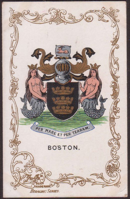
The Boston Coat of Arms.

Early Fire brigade, outside the Municipal Buildings, West Street.

The Lord Nelson Field. (where Nelson Way is now)

Unexploded bomb outside Cammacks shop, Wide Bargate in 1940.

A room of the Whale Inn showing a mosaic of a whale in 1971.

Cheer's shop in West Street.

Soldiers in West Street, returning from the Boer War.

The last commercial sailing ship to leave Boston Dock (Danish).

Blackfriars in 1856.

The old St. Botolph's Church bellringers.

27, Wormgate in 1910.

Where the Waterfront pub is now.

Arme's down West Street.

Strait Bargate in the 1980's.

Bedford's Mill, where the Pizza Hut car park is now on Fydell Crescent.